Cascade Saddle, Lochnager, Shotover Saddle overnighter
2025-02-17 20:46
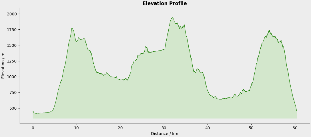
Distance: 59.6 kilometers
Elevation: 4666 meters
Moving Time: 19:35:38
Elapsed Time: 29:46:51
Plus 5km bike out/in at start/end each way.
An absolutely stunning (and tough) couple of days on the feet. This is why I moved to New Zealand. Very lucky to have this at my doorstep.
The weekend started at 3 AM on Saturday. I needed to be out the door by 3.30 AM so I could get into the Matukituki Valley before they closed the road for Challenge Wanaka at 5 AM. I met my mate at the bottom of Treble Cone who was dropping off a couple of others doing a similar adventure over the Harris Mountains.
I wrote Day One notes from the tent at the end of the first day. I wrote Day Two on Sunday night back at home. I crashed as I wrote that and finalised this post on Monday with links and photos and all. I'm also trying out larger images for these types of posts as an experiment.
Day One
[20:09] Camped by the little outlet lake of Lochnager. Good to use the Nemo tent again. Holding up ok on the stone surface. Today was big. 12 hours all up to cover 42km and 3,200m of elevation gain. We rode bikes 5km in. Not sure if it was entirely useful as we were only going 8min/km anyway. We dumped them where we expect to come out tomorrow, at the base of the Shotover Saddle route. On foot the route was very spectacular. I had never been out this way, kind of had an idea from photos I had seen, but was blown away constantly with the massive rock faces and glaciers surrounding us everywhere.
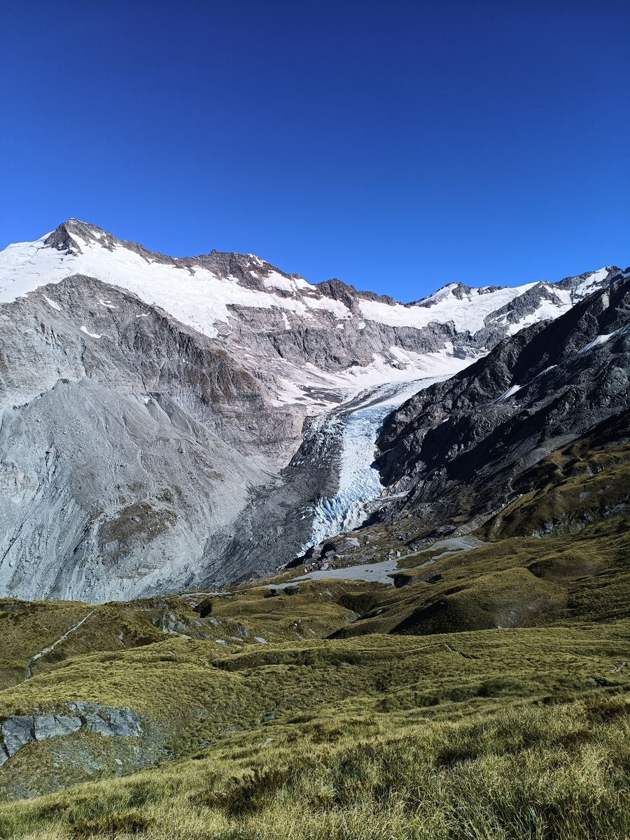
Dart Glacier, with Mt Edward on the left, taken from Cascade Saddle
Rock faces from the valley floor making us feel very small
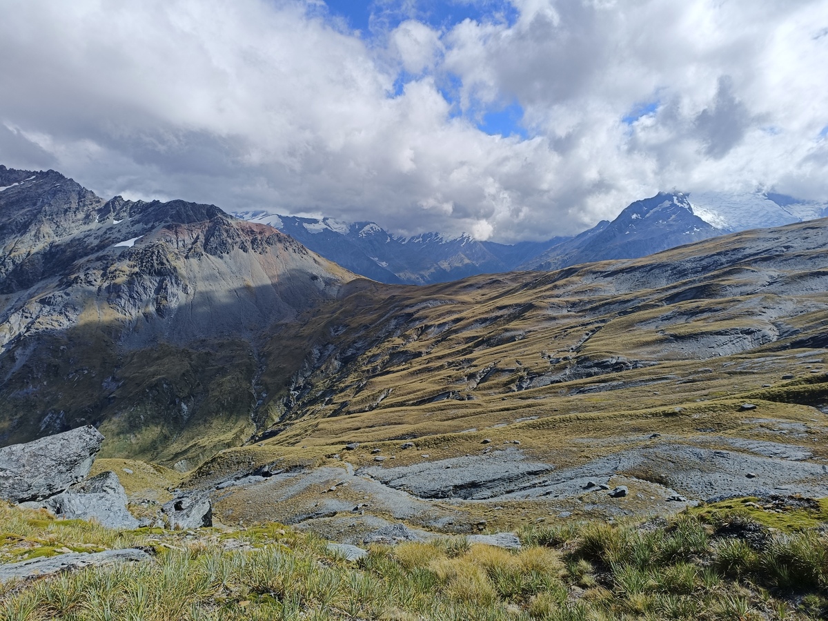
A very photogenic area, and the day was cracking. As far as the terrain goes, the first 30km was a pretty straight forward, if a little hilly, along the Cascade Saddle Route then ducking on to the Dart Track. At Rees Saddle we veered off and continued along Snowy Creek before the climb out of the valley on the SE side so we could get over to Lochnager. Looking back across to Mt Tewha and Tyndall Glacier was spectacular.
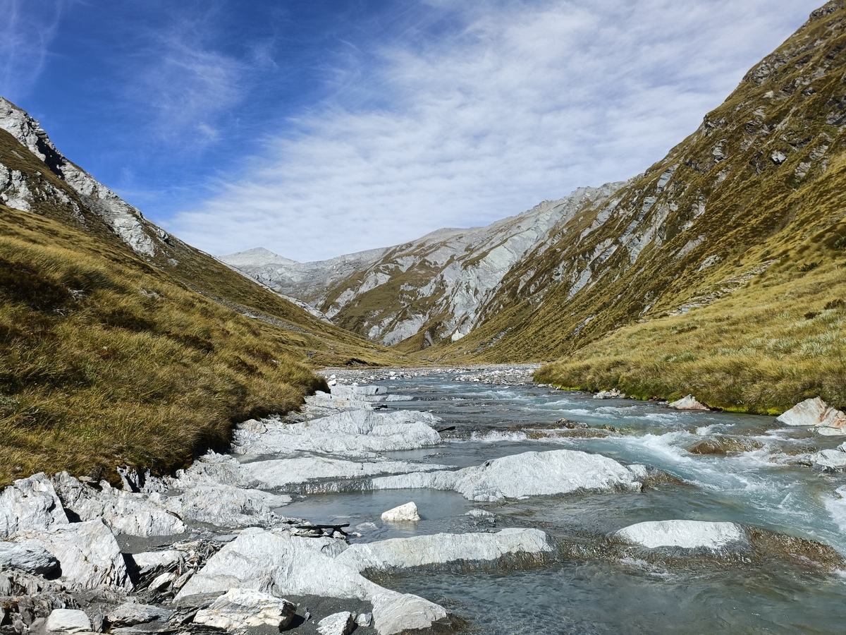
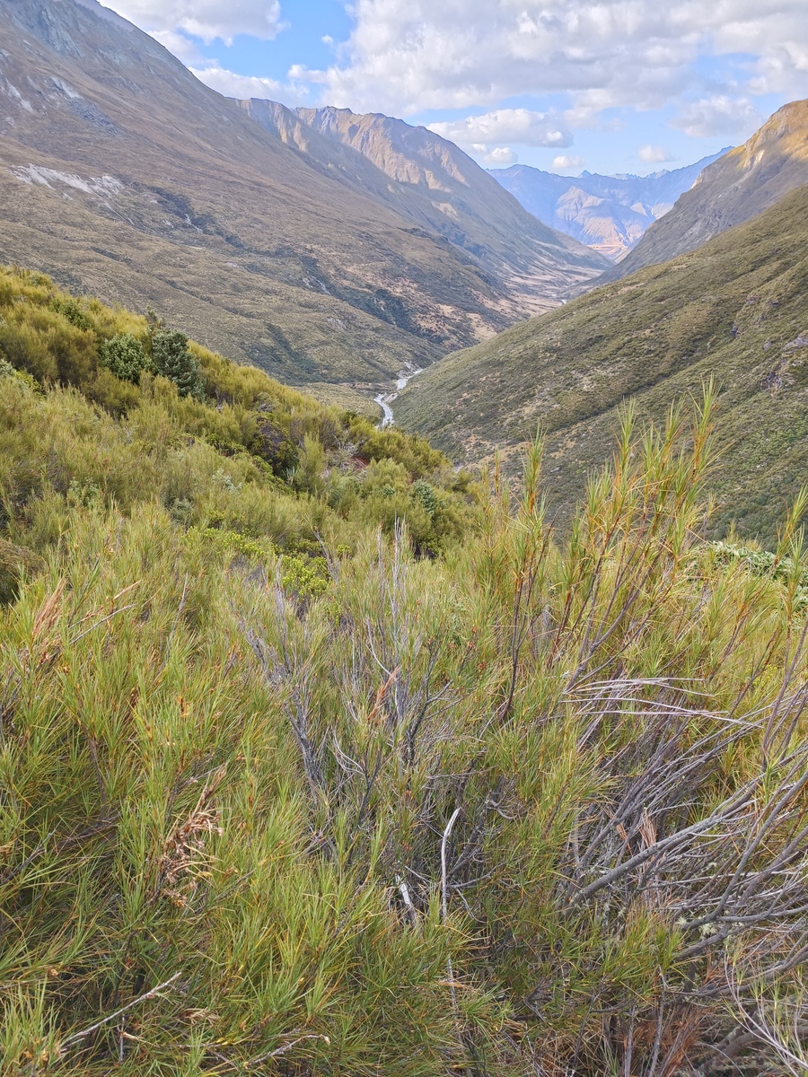
Looking up Snowy Creek, our destination the peak in the distance
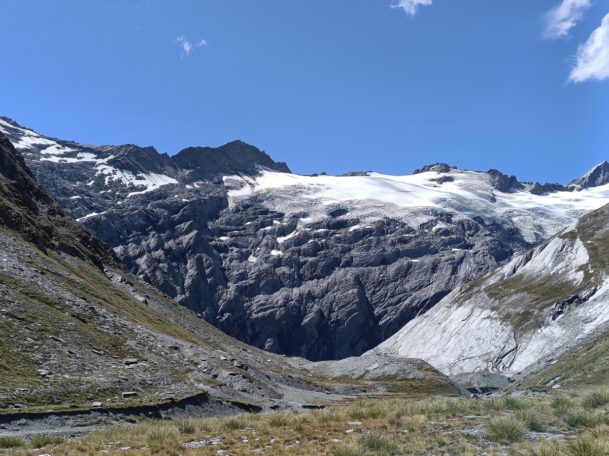
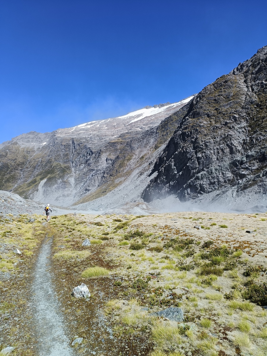
Tyndall Glacier being (what's left of it) and the massive wall of rock underneath being very intimidating
Towards the top there was a tricky climb with crumbly holds to deal with. We got up and agreed it'd be a difficult going the opposite direction, descending. Luckily we didn't need to do that. On the other side after passing another rad looking spot, and C commenting "This is almost too good", right on queue, we had to do some very precarious sidling on the eastern face between pt 2000 and pt 1896 before we could cross over and descend to Lochnager. We had our helmets on, but both felt this was about our limit. This was probably the most exhausting part of the day because it was towards the end (we were already spent) and took us a lot of concentration on the steep slopes. Once past pt 1896 it was a pretty straight forward descent down to the east end of Lochnager. We swam (it was beautiful), pitched our tents out of the westerly coming from the lake, ate our dehydrated meals, drank a hot cuppa and crashed.
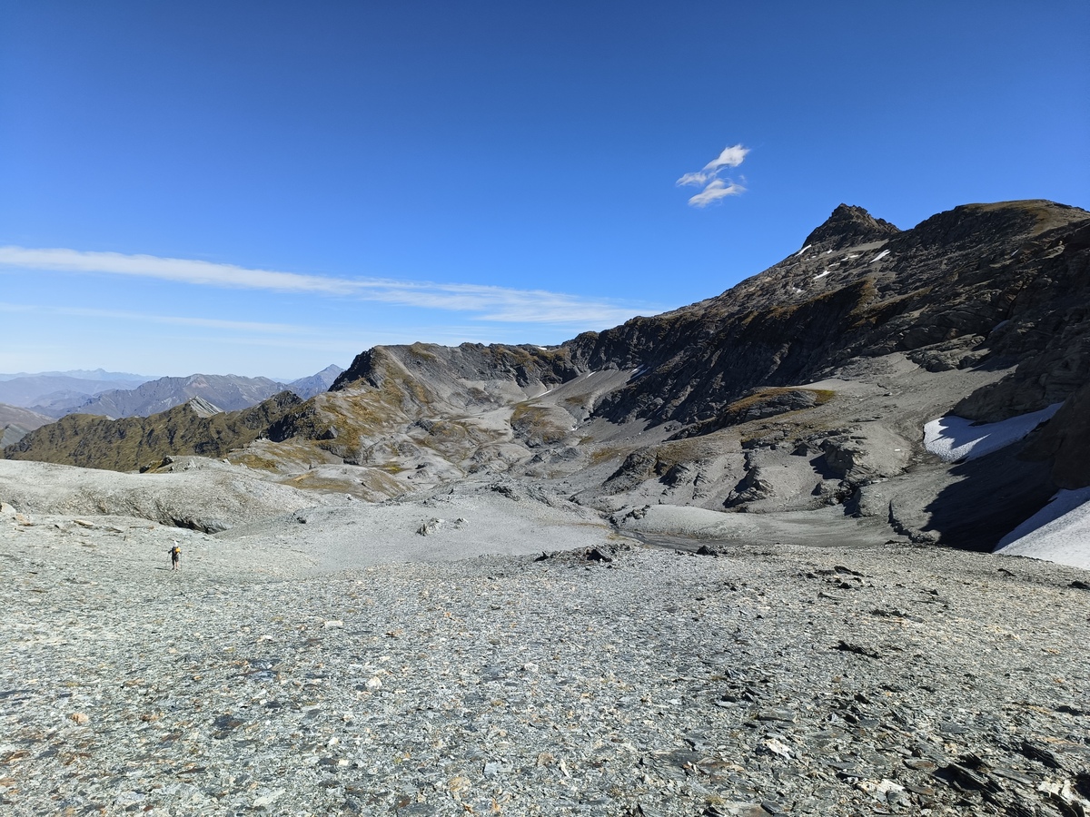
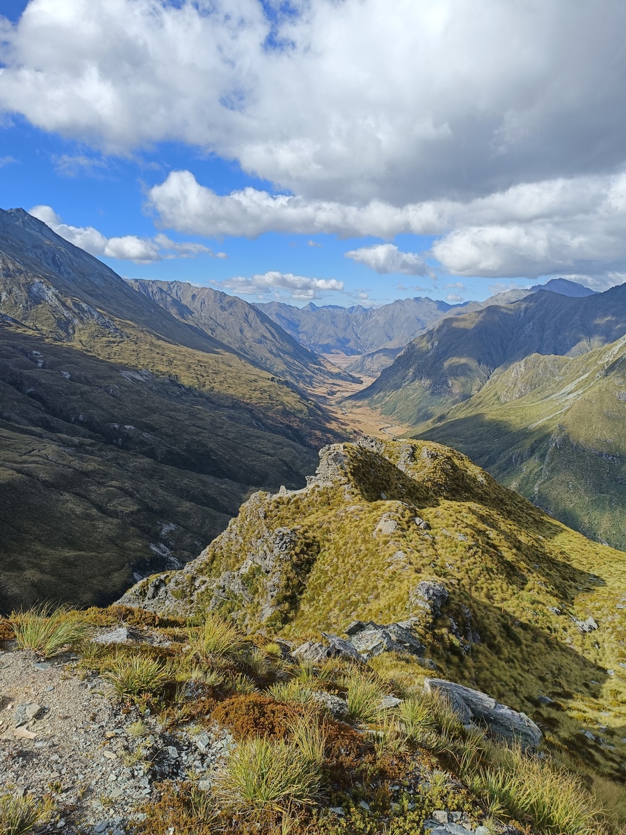
The delightful tops before the difficult ridge sidle over the hill
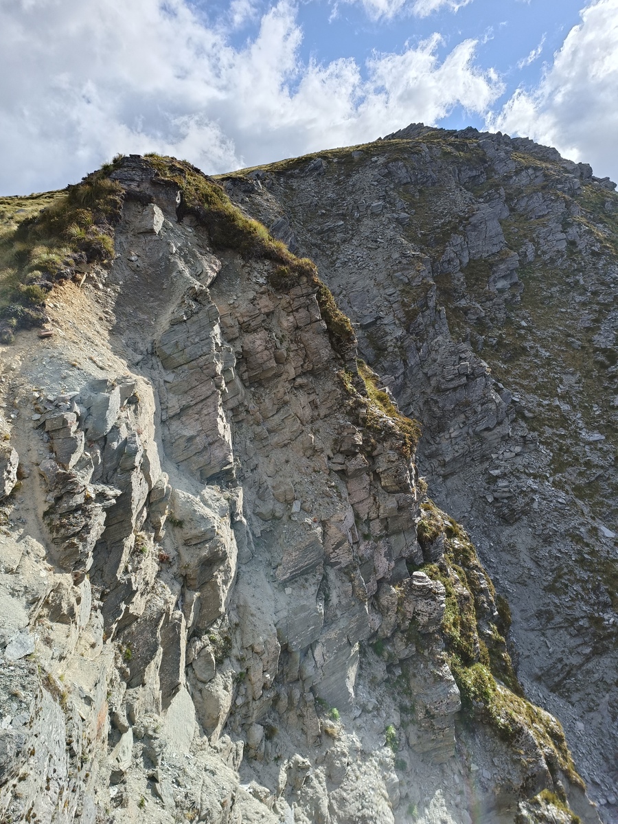
Looking back towards pt 2000 from pt 1896. Hard section
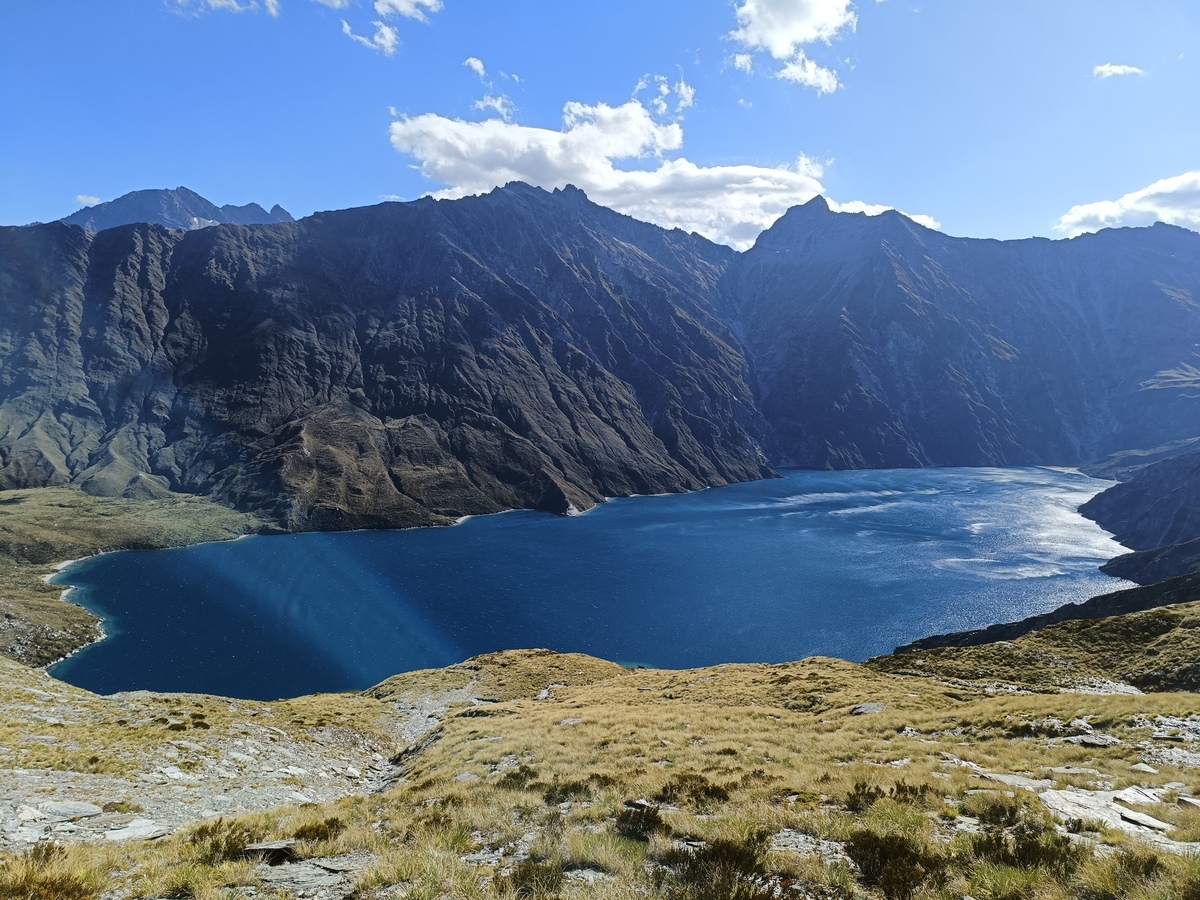
Lochnager. Glad to see it
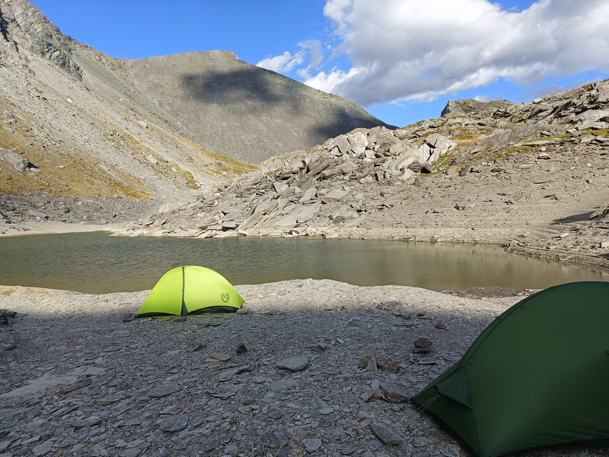
Campsite
Day Two
[03:45] "You awake mate?" I hear from the tent a few meters away. "You know it." Time to get up. I slept like crap, as I usually do in a tent. My right knee gave me grief all night. I vaguely remember over-extending it the day before in a hidden hole between two rocks. I've done this a couple times now. Need to watch that. Anyway early start suits me. We were off by [4.20AM], headtorches on with an easy descent down to Shotover River via a marked route, sometimes tricky to find in the dark. Easy treck up the Shotover River through a farm paddock for a few kilometers, passing the morning cow congregations. This was a nice start to the day after yesterday's taxing traverse above Lochnager. Back in conservation land a prickly and potentially unnecessary sidle through scrub on the eastern side of the river. Eventually we scaled back down and walked through the river instead which was much easier. The climb up at the end of the valley from Tummel Burn Hut was very slow. Straight up through thick bush with bluffs to navigate. Took us a good 2 hours for 2km, a lot of ducking under and above branches, climbing roots and trees at precarious angles, and the odd curse word letting rip. Once in the clearing it was relatively straight forward (and up!), following the ridge, and start to sidle as we neared the top, aiming for the Shotover Saddle. The 1000m descent back to the bikes was long and steep.
Appearing above the scrub, above the bush, above the Shotover River, absolutely battered
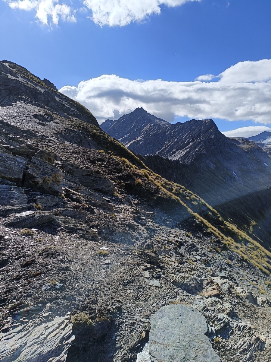
A bit higher up along the ridge looking back over Shotover River again
Following the ridge up towards Shotover Saddle
Shotover Saddle and the final descent below. Rob Roy Glacier on the right
We were grateful for the bikes in the end, a slight descent and tailwind to get us back to the car was a delight. We were both truly buggered. Both agreed overall it was a cracker, though not for everyone. Some bits above Lochnager wouldn't sit well with many. 5000m over 60km aint small either. It was a great introduction to an area a bit more north of my usual haunts, and has opened up a whole new bunch of ideas for new routes for me.