Eldrig Peak, Mt Burns loop
2025-02-06 19:00
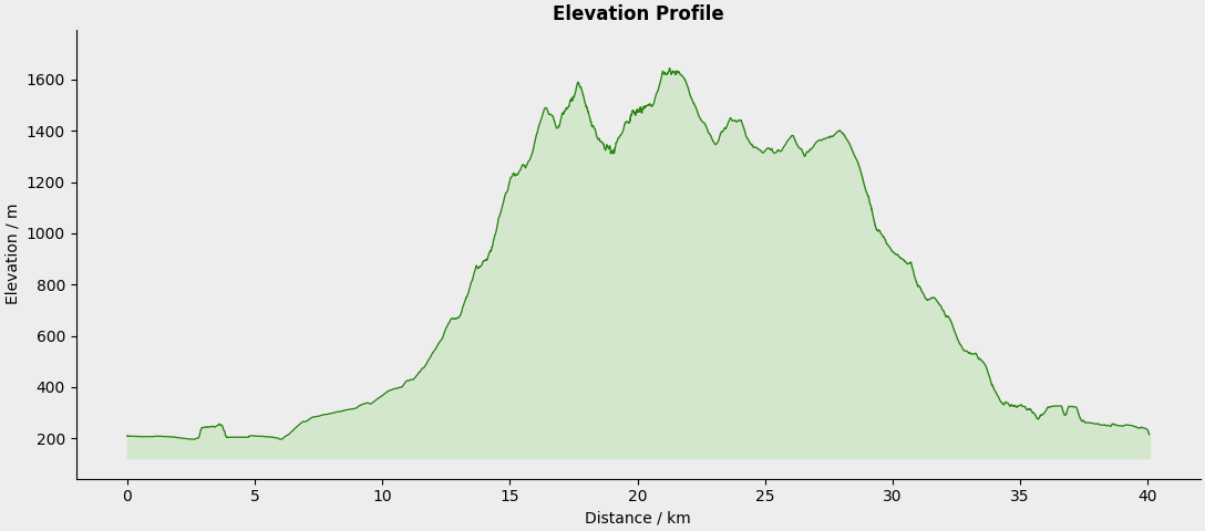
Distance: 39.62 kilometers
Elevation: 2479 meters
Moving Time: 9:34:41
Elapsed Time: 10:11:49
With a public holiday (Waitangi Day), and a mate visiting on the weekend I did my long-run early (Thursday, I usually save it for the weekend) and headed out to the Green Lake area, bordering Southland and Fiordland. Leaving at 5 AM, I didn't get home til 8:30 PM. It was a big day. Classic weather down there, visibility was nil all day long, rain overnight and spotty all day long, which made it tricky for the terrain I was covering.
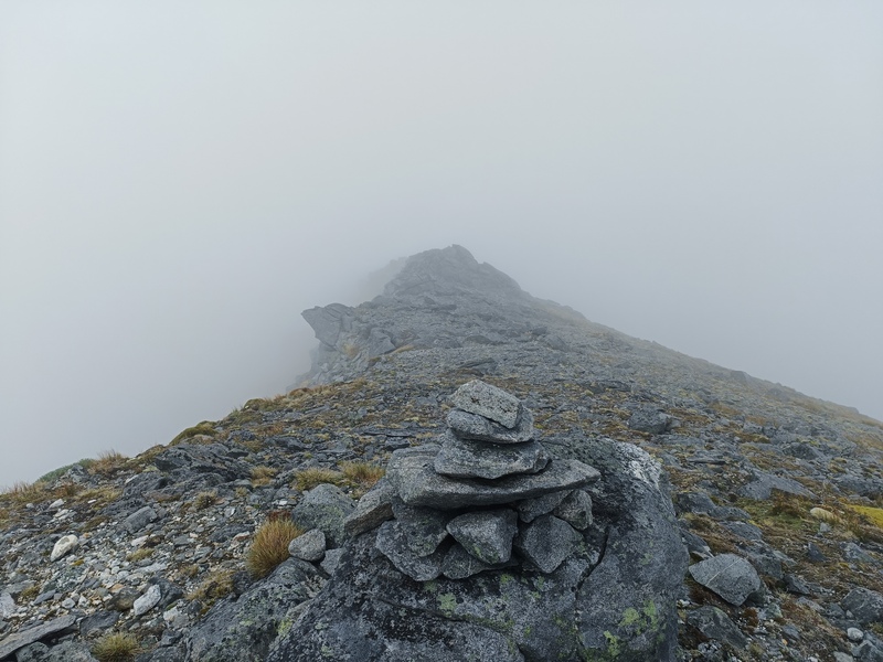
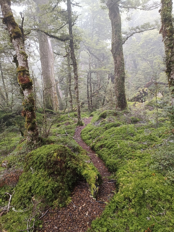
Starting at the Green Lake trailhead I stated my anti clockwise loop with some simple yet beautiful single track through the wetlands towards Borland Lodge. A slight incline along the dirt Borland Road, and then the fun began. First climb through the forest up Eldrig Peak Track, raining on me to ensure I was thoroughly soaked just for kicks. At the top becomes a muddy slush on grassy terrain. Couldn't see a thing but managed to find the last two markers before I was on my own.
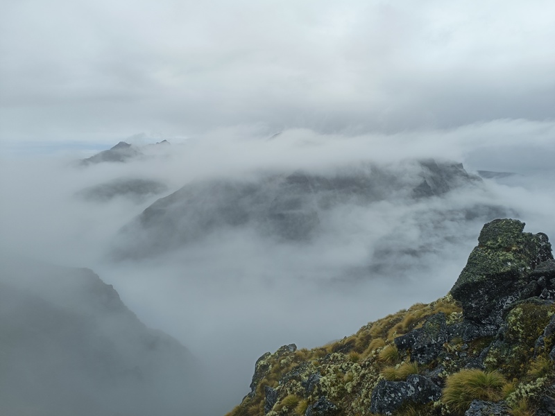
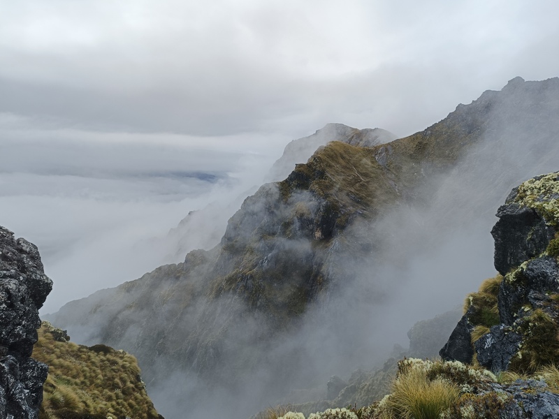
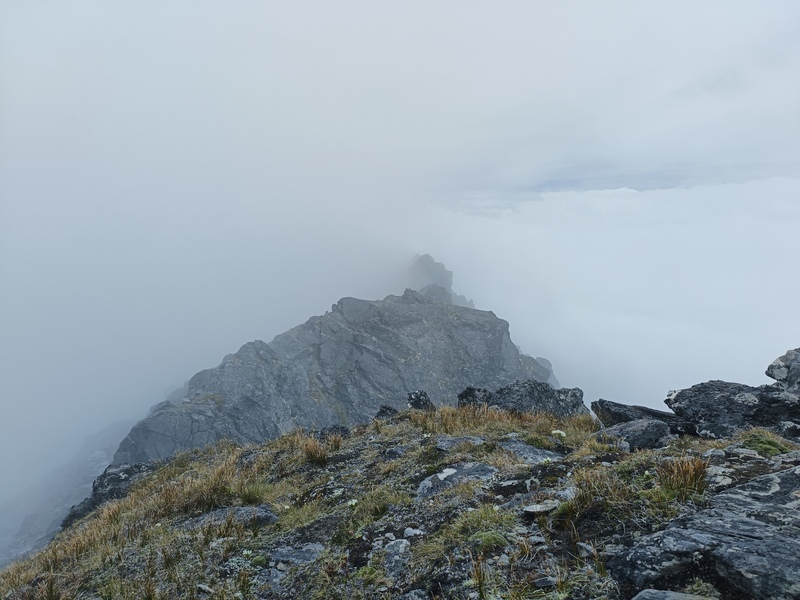
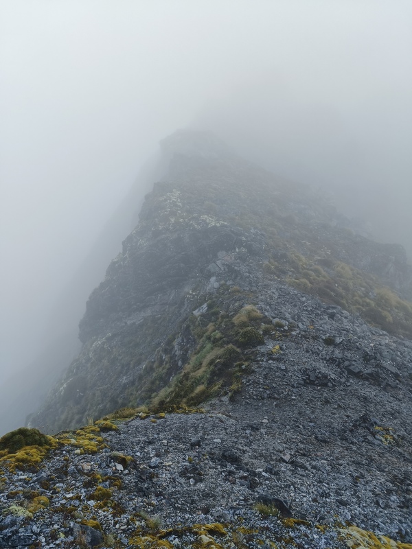
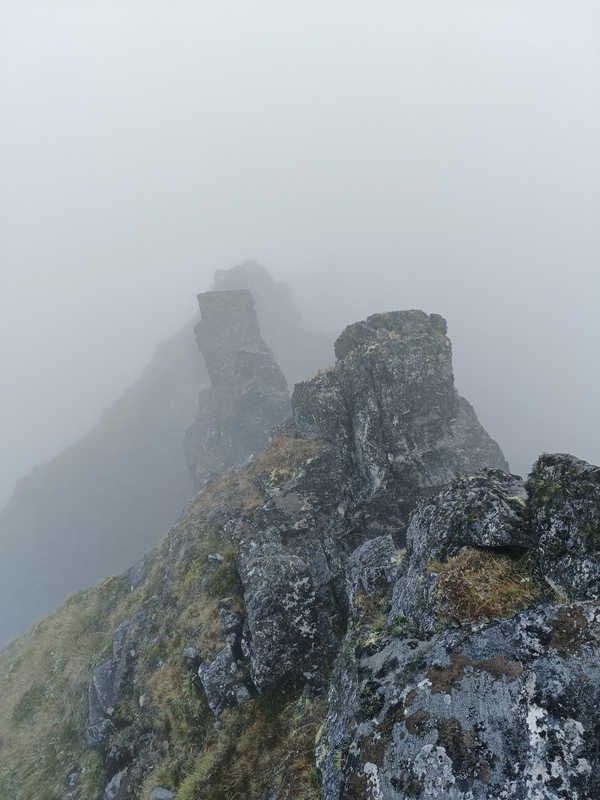
Ok now the fun actually begins. I used my map regularly to keep myself following the correct ridge lines. There are many spurs leading up to the main ridge I was following so with 50, sometimes 5 meters visibility it was easy to make the wrong turn and head down the wrong route. I had done this once before on a bluebird day so this was a very different experience. I nearly turned around because it simply was a bit too bleak and concerning with the difficulty of terrain. I first thought I'll get to Eldrig Peak and make the decision there to turn back or continue on. Once at Eldrig there was a small 5 minute window of almost blue sky, a bird that chirped to say "hey mate, I'm here with ya, how good is this slight glimpse of our surrounds?" That was enough for me to continue on. It clagged in once again for the rest of the traverse.
It was a solid 10km of difficult ridge scrambling which included razer edges, finger width ledges, a couple of leaps even, and when too hard some very careful sidling in the steep wet tussock, rock and shale. Every step was a calculated assessment of risk. Very taxing on the mind.
Once back on the main Green Lake track it was smooth sailing. I passed 3 hikers who were planning on doing the same route in reverse over 3 days. They had questions, I gave some pointers. I think they'll be sidling a lot more with their big packs. They would be getting some sun today at least while they are up on the tops. Lucky them.
Back at work today and the legs were certainly feeling it. Moving about helps though, and there wasn't much crouching today thank God.
These are the types of missions why I do this. Absolutely kicked my mojo through the roof. Glad I didn't turn around when I was thinking about it.